Landscape and classification
The experience and observation first hand of wild places brings with it much joy for many people. I liken it to a nurturing relationship with the natural environment. There is now scientific evidence of the effect natural environments have on human brain activity. A calming effect, also reported by many as stress relief. I hope my photographs convey a part of that experience, because images of nature have been reported to evoke similar responses, but not at the same magnitude. Wilderness can also be a place of discovery. We may find scores of living creatures and observe complicated energy flows from one state into another. One of these flows (literally) is the movement of water through a landscape known as Hydrology. Another is the repeating cycles of growth and decay in the Biomass. It can be argued there are few natural environments on Earth free of human interference. Yet there are still plenty of places that retain their essential wilderness and the experiences they embody.
Conservation of these wild places relies on their recognition. By what criterion do we identify them? When assessing landscapes we must note there are a multitude of approaches to their classification. Since Landsat imagery was first collected around 1972, together with an advancement in data processing, the increasing resolution has resulted in more accurate modeling. Today, the entire landmass of Earth is mapped and categorized into a framework of economic and conservation value. Original wild nature yields at the hand of human intervention toward agriculture, mining, civil infrastructure, industry, urban and recreation areas. Thus, the intent of humanity is mapped into the land (planet) we walk upon. Like the concept of palimpsest, human updates are often larger, faster, straighter, or denser.
Landscape Ecology is the study of relationships between various energy flows within a specific study area. Some of those flows are ecological, that is dealing with life forms and Geo-morphology, while others attempt to integrate with anthropocentric modifications. What constitutes a study area can be quite different. Picture steep wooded terrain too difficult to clear (now with a high conservation value) compared to urbanization that necessarily needs a viable (often flat) landscape. The lay of heterogeneous patches of different landscape usage can be very ordered such as fields and towns, following invented boundaries, or amorphic shapes following natural boundaries such as geological features. Sometimes these are intermixed.
The worlds industrialized cultures (of which this photographer is a member) are constantly redefining the use of landscape. This can lead to disturbed, decayed or restored landscapes, some in transition from one use to another. I find these places fascinating rather than beautiful (although these qualities are not mutually exclusive). They contain a cultural story, often tied to economics and resources.
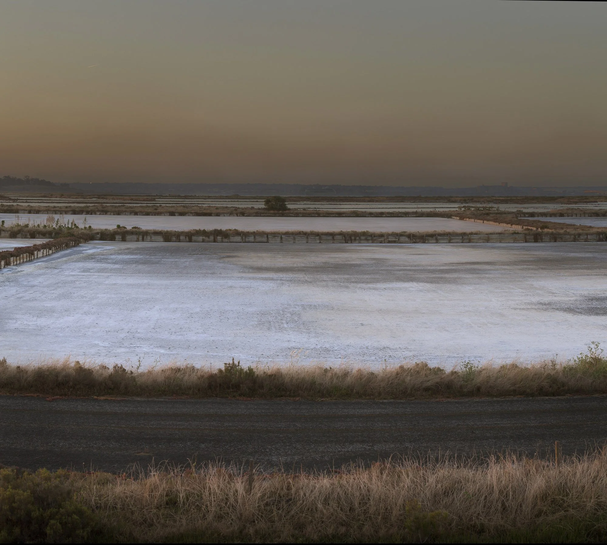
Part of an abandoned salt farm near Geelong in Victoria. Debate rages regarding its repurposing. At the moment it is home to many birds, and the occasional photographer.
A suite of metrics can be used to collect landscape information, here are some of the data sets used: Ecological, User participation, Identity sense of place, Scenic and aesthetic, Biodiversity, Architecture and heritage, Altitude, Land management practice, History, Geo morphology, Climate, infrastructure and urbanization, Agriculture, Hydrology, Soil, Vegetation, plus others that may relate to specific parcels or study areas.
Large data sets amass, so you need to know what your looking for. From my perspective it obviously relates to visual, historical, and anthropocentric modifications relative to what we call ‘natural’. Natural is a relative concept, depending on your study methodology. In a temporal context the land is constantly changing even in completely natural conditions. Soils move over extended periods while moisture can be transported from one place to another relatively quickly. Perhaps measured in minutes. As a photographer it is difficult to engage with long term processes, those extending beyond a few years at most (Example; urbanization). Change in biodiversity is equally difficult to capture in imagery, this sort of data is best stored in analysis records. So a photographer is really left with what is happening now. This minute or this second, a moment frozen in time. However, this is also a valuable record just in a different way. Consider aerial photographic mapping for example. The art photographer in this space may be looking for something that’s descriptive, interesting or even visually attractive all at the same time, a combination not always forthcoming.
Its a delight for me when this subject matter results in a captured image that is also compelling to look at in some way.

An urban development on the fringe of Melbourne repurposes farmland. Seen though a sound barrier, while remnant vegetation re-sprouts.
The same development after services infrastructure, but before housing.
Most land parcels are dedicated to a single dominant use; urban house blocks, a recreational park or an industrial estate as examples. Rural landscapes are primarily industrial. Transport infrastructure overlays nearly all use scenarios, but this is confined to narrow strips dedicated to that dominant use. A wind farm situated on rural land is a large area with dual usage. Agriculture and service industry share the space, neither is greatly impacted by the proximity of the other. It is hard to think of other large tracts that have two concurrent equal uses.